

What is the concept and function of GPS RC Drone
2025-05-09
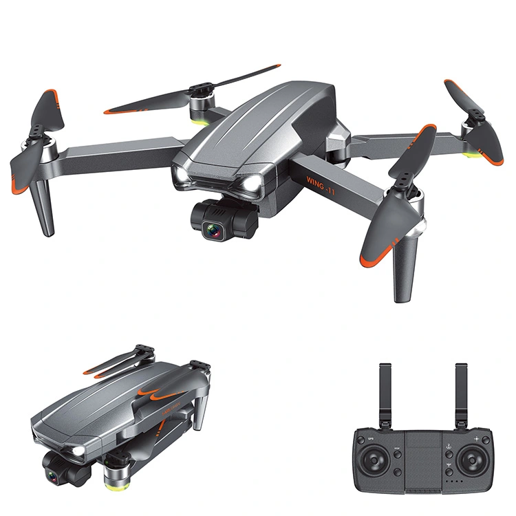
A GPS RC drone is a remote-controlled drone (RC drone) equipped with Global Positioning System (GPS) technology. This integration significantly enhances the drone's capabilities and performance. Here's a breakdown of its concept and function:
Concept of a GPS RC Drone
A GPS RC drone combines:
A flying quadcopter or similar UAV (Unmanned Aerial Vehicle).
Remote control capabilities (via a transmitter or smartphone app).
GPS module for satellite-based location tracking.
The core concept is to allow the drone to determine its precise geographic location in real time, which enables more advanced navigation, automation, and safety features compared to non-GPS drones.
Functions of a GPS RC Drone
1. Position Hold
The drone can hover in place without drifting, using satellite coordinates to maintain a fixed location even in light wind.
2. Return to Home (RTH)
Automatically returns to its takeoff point when:
Signal is lost
Battery is low
User activates RTH manually
3. Waypoint Navigation
Users can set specific GPS coordinates on a map.
The drone flies autonomously between these points.
4. Follow Me Mode
The drone locks onto the GPS signal of a controller or smartphone and follows the user.
5. Flight Path Recording
Some drones record the path taken, useful for repeating flights or reviewing routes.
6. Geofencing / No-Fly Zones
GPS allows restriction of flight zones (e.g., near airports), improving safety and regulatory compliance.
Benefits
Improved stability and flight accuracy
Easier for beginners to fly
Enables autonomous features
Safer flight through RTH and geofencing
If you are interested in our products or have any questions, please feel free to contact us and we will reply you within 24 hours.